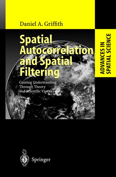
Spatial Autocorrelation and Spatial Filtering Gaining Understanding Through Theory and Scientific Visualization
-
- Hardcover ausgewählt
- Taschenbuch
-
Sprache:Englisch
139,99 €
UVP
160,49 €
inkl. gesetzl. MwSt.,
Beschreibung
Produktdetails
Einband
Gebundene Ausgabe
Erscheinungsdatum
10.07.2003
Verlag
Springer BerlinSeitenzahl
250
Maße (L/B/H)
24,1/16/2 cm
Gewicht
571 g
Auflage
2003
Sprache
Englisch
ISBN
978-3-540-00932-0
Exploiting the old maxim that "a picture is worth a thousand words," scientific visualization may be defined as the transformation of numerical scientific data into informative graphical displays. It introduces a nonverbal model into subdisciplines that hitherto employed mostly or only mathematical or verbal-conceptual models. The focus of this monograph is on how scientific visualization can help revolutionize the manner in which the tendencies for (dis)similar numerical values to cluster together in location on a map are explored and analyzed, affording spatial data analyses that are better understood, presented, and used. In doing so, the concept known as spatial autocorrelation - which characterizes these tendencies and is one of the key features of georeferenced data, or data tagged to the earth's surface - is further de-mystified. This self-correlation arises from relative locations in geographic space.
Noch keine Bewertungen vorhanden
Verfassen Sie die erste Bewertung zu diesem Artikel
Helfen Sie anderen Kundinnen und Kunden durch Ihre Meinung.
Kurze Frage zu unserer Seite
Vielen Dank für Ihr Feedback
Wir nutzen Ihr Feedback, um unsere Produktseiten zu verbessern. Bitte haben Sie Verständnis, dass wir Ihnen keine Rückmeldung geben können. Falls Sie Kontakt mit uns aufnehmen möchten, können Sie sich aber gerne an unseren Kund*innenservice wenden.
zum Kundenservice