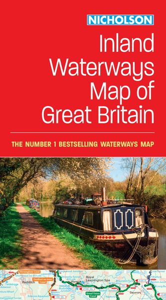
Nicholson Inland Waterways Map of Great Britain For Everyone with an Interest in Britain's Canals and Rivers
-
- Englisch ausgewählt
11,99 €
inkl. gesetzl. MwSt.,
Beschreibung
Produktdetails
Einband
Karte
Altersempfehlung
ab 13 Jahr(e)
Erscheinungsdatum
15.02.2024
Verlag
Collins ELTMaße (L/B/H)
24/13,2/1 cm
Gewicht
140 g
Sprache
Englisch
ISBN
978-0-00-865287-6
The best-selling guides to Britain's canals and rivers for more than 50 years.
The map companion to the Collins Nicholson Waterways Guides, covering the entire network of canal and river navigations in England, Scotland and Wales, including newly restored/opened canals and rivers.
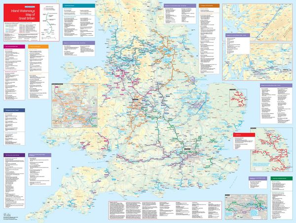
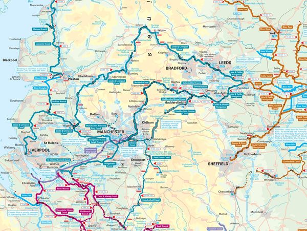
The map identifies:
¿ narrow and broad canals
¿ navigable rivers
¿ tidal river navigations
¿ waterways under construction
Also:
¿ contact telephone numbers and dimensions for each waterway
¿ internet links
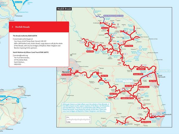
Clear insets of the Birmingham Canal Navigations, Scottish inland waterways, the Norfolk Broads and the London area.
Kundinnen und Kunden meinen
Verfassen Sie die erste Bewertung zu diesem Artikel
Helfen Sie anderen Kund*innen durch Ihre Meinung
Kurze Frage zu unserer Seite
Vielen Dank für Ihr Feedback
Wir nutzen Ihr Feedback, um unsere Produktseiten zu verbessern. Bitte haben Sie Verständnis, dass wir Ihnen keine Rückmeldung geben können. Falls Sie Kontakt mit uns aufnehmen möchten, können Sie sich aber gerne an unseren Kund*innenservice wenden.
zum Kundenservice