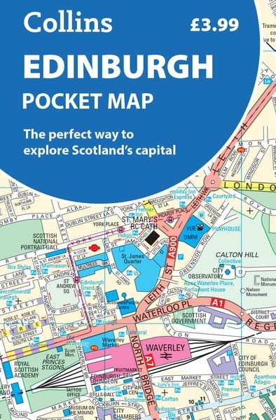

Edinburgh Pocket Map The Perfect Way to Explore Edinburgh
-
- Englisch ausgewählt
5,99 €
inkl. gesetzl. MwSt.,
Beschreibung
Produktdetails
Einband
Karte
Altersempfehlung
ab 13 Jahr(e)
Erscheinungsdatum
11.04.2024
Verlag
Collins ELTMaße (L/B/H)
14,3/9,8/0,4 cm
Gewicht
42 g
Sprache
Englisch
ISBN
978-0-00-866346-9
Explore new places with handy pocket maps from Collins.
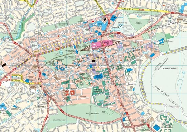
Handy little full-colour map of central Edinburgh with a high level of detail. Clear mapping from Leith in the north to The Meadows in the south, and Edinburgh Zoo in the west to Holyrood Park in the east.
Clear, detailed, full colour mapping is presented in a handy format ideal for the pocket or handbag. It is excellent value and covers the most visited area of central Edinburgh. It is an essential buy for tourists and residents alike.
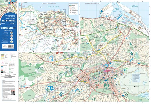
This map includes:
¿ Detailed central area map
¿ Around Edinburgh map extending to airport, Pentland Hills and Forth Road Bridge
¿ Tourist locations
¿ Tram, train and bus stations
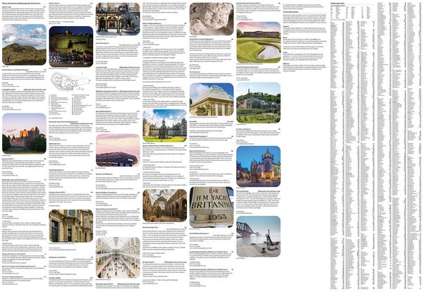
¿ Listing of major places to visit, with additional details for Edinburgh Castle and Holyrood Palace
¿ Detailed street index
¿ Now with NEW electric charge point data from Zapmap!
Map at a scale of 1:11,000 (6 inches to 1 mile).
Kundinnen und Kunden meinen
Verfassen Sie die erste Bewertung zu diesem Artikel
Helfen Sie anderen Kund*innen durch Ihre Meinung
Kurze Frage zu unserer Seite
Vielen Dank für Ihr Feedback
Wir nutzen Ihr Feedback, um unsere Produktseiten zu verbessern. Bitte haben Sie Verständnis, dass wir Ihnen keine Rückmeldung geben können. Falls Sie Kontakt mit uns aufnehmen möchten, können Sie sich aber gerne an unseren Kund*innenservice wenden.
zum Kundenservice