Beschreibung
Produktdetails
Einband
Taschenbuch
Erscheinungsdatum
04.07.2024
Verlag
HarperCollinsSeitenzahl
120
Maße (L/B/H)
23,7/16,7/0,7 cm
Gewicht
230 g
Auflage
4 Revised edition
Sprache
Englisch
ISBN
978-0-00-865284-5
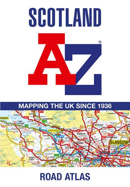
Navigate your way around Scotland with this detailed, full-colour and easy-to-use A-Z Road Atlas.
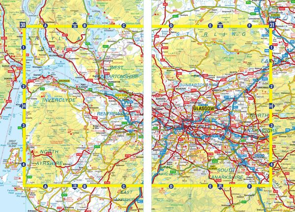
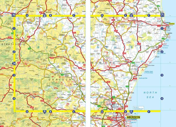
From the border to the north coast, the mainland pages scale is 3.5 miles to 1 inch and the Western Isles, Shetland Islands and Orkney Islands scale is 4.5 miles to 1 inch.
Covering the entire country, this road atlas includes the following features:
¿ Motorways with full junction detail, primary routes and destinations, A & B roads, under construction and proposed roads, service areas, tolls, mileages, national, county and unitary authority boundaries
¿ Cairngorms and Loch Lomond & The Trossachs National Park boundaries
¿ Selected places of interest and tourist information centres
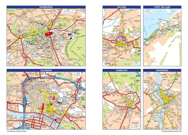
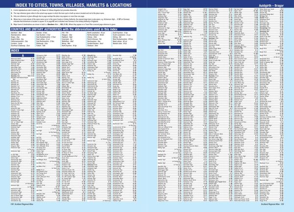
20 city and town street maps are included for Aberdeen, Aviemore, Ayr, Dumfries, Dundee, Dunfermline, Edinburgh, Glasgow, Falkirk, Fort William, Hamilton, Inverness, Kilmarnock, Kirkcaldy, Motherwell, Oban, Paisley, Perth, St Andrews and Stirling. Also included is a comprehensive index to cities, towns, villages, hamlets and locations.
Kundinnen und Kunden meinen
Verfassen Sie die erste Bewertung zu diesem Artikel
Helfen Sie anderen Kund*innen durch Ihre Meinung
Kurze Frage zu unserer Seite
Vielen Dank für Ihr Feedback
Wir nutzen Ihr Feedback, um unsere Produktseiten zu verbessern. Bitte haben Sie Verständnis, dass wir Ihnen keine Rückmeldung geben können. Falls Sie Kontakt mit uns aufnehmen möchten, können Sie sich aber gerne an unseren Kund*innenservice wenden.
zum Kundenservice