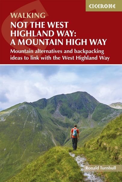
Not the West Highland Way: A Mountain High Way Mountain alternatives and backpacking ideas to link with the West Highland Way
-
- Taschenbuch
- eBook ausgewählt
-
Form:Einzelkauf Download
-
Sprache:Englisch
26,49 €
inkl. gesetzl. MwSt.Beschreibung
Produktdetails
Format
ePUB
Kopierschutz
Nein
Family Sharing
Nein
Text-to-Speech
Ja
Erscheinungsdatum
13.05.2025
Verlag
Cicerone PressSeitenzahl
224 (Printausgabe)
Dateigröße
126546 KB
Auflage
2. Auflage
Sprache
Englisch
EAN
9781787650909
Experience the West Highland Way as you've never seen it before. Not the West Highland Way: A Mountain High Way explores a series of alternative day walks, mountain routes and multi-day options that run alongside, above and beyond Scotland's most popular long-distance trail. From Milngavie to Fort William, these routes swap busy paths and low-level tracks for high ridges, classic peaks and sweeping Highland views, offering a wilder, more challenging way to engage with this iconic landscape.
Designed for walkers who want to go beyond the standard 96-mile route, this guidebook shows how to build tougher, more adventurous itineraries using high-level detours, standalone mountain days or linked multi-day routes. It's ideal for experienced hillwalkers, return visitors to the West Highland Way, or anyone looking to combine iconic scenery with greater challenge and solitude.
- The guidebook includes 14 alternative mountain variants and side loops, ranging from roughly 1029km with ascents from around 6501600m, giving you options for single high-level days above almost every stage of the standard West Highland Way
- Two beginner-friendly two-day backpacking trips are also described, offering a gentle introduction to wild camping and hut nights while staying close to the security and facilities of the main trail
- Three extended multi-day adventures go beyond the West Highland Way itself including routes such as Corrour to Dalwhinnie and Fort William to Inverie opening up wilder corners of Rannoch, Knoydart and the central Highlands for those with extra time
- Practical information on access, mapping choices and mountain safety is woven throughout, helping you judge weather, terrain and commitment levels before leaving the valley path for more exposed hill crossings in the Highlands
- Get the level of navigational detail you expect from a Cicerone guidebook: detailed route descriptions, OS mapping and GPX files for digital navigation across unbeatable Scottish landscapes
Featuring iconic landscapes such as Ben Lomond, Ben Lui, the Black Mount, the Mamores, Loch Etive and Glen Nevis, this guidebook unlocks some of the Highlands' most dramatic scenery. These routes lift you above the crowds, turning well-trodden glens into high-level mountain journeys defined by sweeping ridges, cascading waterfalls and expansive Highland views.
Kundinnen und Kunden meinen
Verfassen Sie die erste Bewertung zu diesem Artikel
Helfen Sie anderen Kund*innen durch Ihre Meinung
Kurze Frage zu unserer Seite
Vielen Dank für Ihr Feedback
Wir nutzen Ihr Feedback, um unsere Produktseiten zu verbessern. Bitte haben Sie Verständnis, dass wir Ihnen keine Rückmeldung geben können. Falls Sie Kontakt mit uns aufnehmen möchten, können Sie sich aber gerne an unseren Kund*innenservice wenden.
zum Kundenservice